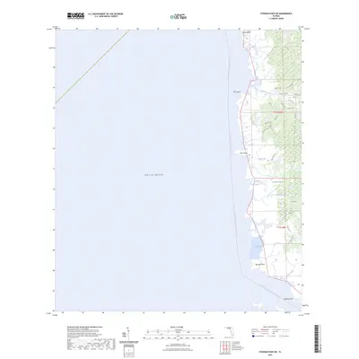
2024 Map of Steinhatchee SW
USGS Topo · Published 2024About this map
Gulf of Mexico coastal marshlands and intricate tidal inlets define this portion of the Dixie County shoreline. The landscape is a network of slow-moving water bodies including Sink Creek, Days Creek, and Rocky Creek, which thread through the low-lying interior toward the coast. Significant sections of the terrain are identified as Pumpkin Swamp, indicating a region dominated by hydric environments where land and water blur. Along the immediate coast, geographic markers such as Bowlegs Point, Hardy Point, and Halfway Point define the jagged edge of the mainland, while small landmasses like Bird Island and Tater Island sit just offshore.
Find a feature on this map
33 named features on this map. Tap any name to fly to it.
Don’t see what you’re looking for? This feature index may not catch every label — zoom into the map to look around manually.
Map Details
Editions of this 2024 Steinhatchee SW Map
This is the sole edition of this map. No revisions or reprints were ever made.
Other maps of this area

1954 · Steinhatchee SW
USGS Topo · 1:24,000

1954 · Jena
USGS Topo · 1:24,000

1954 · Steinhatchee
USGS Topo · 1:24,000

1954 · Steinhatchee SE
USGS Topo · 1:24,000

1954 · Horseshoe Beach
USGS Topo · 1:24,000

1954 · Crooked Point
USGS Topo · 1:24,000

1954 · Gainesville
USGS Topo · 1:250,000

1958 · Gainesville
USGS Topo · 1:250,000

1959 · Gainesville
USGS Topo · 1:250,000

1978 · Cedar Keys
USGS Topo · 1:100,000