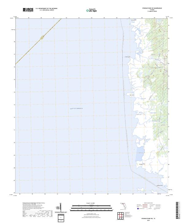
2025 Map of Steinhatchee SW
USGS Topo · Published 2025About this map
The salt marshes and coastal wetlands of the Florida Big Bend define this coastline where the Gulf of America meets Dixie County. This low-lying landscape is characterized by a complex network of tidal creeks and brackish wetlands, including Pumpkin Swamp and Sink Creek. Coastal landmarks such as Bowlegs Point and Hardy Point mark the uneven shore, while inland hammocks and islands like Tater Island rise slightly above the surrounding muck. A modern recreational artery, the Florida Circumnavigational Paddling Trail Trl, skirts the shoreline, providing a designated route through the shallow waters of Bull Cove and past Bird Island. The map records a sparsely populated interior crisscrossed by local roads like Co Rd 361, providing access to the remote hunting and fishing grounds of the Big Bend region.
Find a feature on this map
30 named features on this map. Tap any name to fly to it.
Don’t see what you’re looking for? This feature index may not catch every label — zoom into the map to look around manually.
Map Details
Editions of this 2025 Steinhatchee SW Map
This is the sole edition of this map. No revisions or reprints were ever made.
Other maps of this area

1954 · Steinhatchee SW
USGS Topo · 1:24,000

1954 · Jena
USGS Topo · 1:24,000

1954 · Steinhatchee
USGS Topo · 1:24,000

1954 · Steinhatchee SE
USGS Topo · 1:24,000

1954 · Horseshoe Beach
USGS Topo · 1:24,000

1954 · Crooked Point
USGS Topo · 1:24,000

1954 · Gainesville
USGS Topo · 1:250,000

1958 · Gainesville
USGS Topo · 1:250,000

1959 · Gainesville
USGS Topo · 1:250,000

1978 · Cedar Keys
USGS Topo · 1:100,000