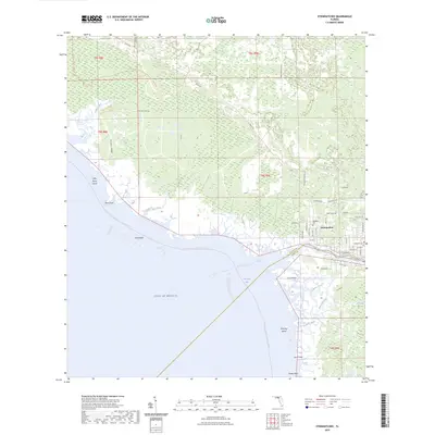
2024 Map of Steinhatchee
USGS Topo · Published 2024About this map
The Steinhatchee River serves as the primary artery and boundary between Taylor and Dixie Counties as it flows into Deadman Bay. The settlement of Steinhatchee is the focal point of the region, featuring a residential grid with local landmarks such as Stephens Cem and thoroughfares like Stephensville Rd and Riverside Dr. This coastal landscape is dominated by the transition from upland features like Hickory Ridge to the tidal environments of the Big Bend Wildlife Management Area Tide Swamp Trl.
Find a feature on this map
60 named features on this map. Tap any name to fly to it.
Don’t see what you’re looking for? This feature index may not catch every label — zoom into the map to look around manually.
Map Details
Editions of this 2024 Steinhatchee Map
This is the sole edition of this map. No revisions or reprints were ever made.
Other maps of this area

1954 · Steinhatchee SW
USGS Topo · 1:24,000

1954 · Clara
USGS Topo · 1:24,000

1954 · Salem SW
USGS Topo · 1:24,000

1954 · Jena
USGS Topo · 1:24,000

1954 · Steinhatchee
USGS Topo · 1:24,000

1954 · Steinhatchee SE
USGS Topo · 1:24,000

1954 · Keaton Beach
USGS Topo · 1:24,000

1954 · Crooked Point
USGS Topo · 1:24,000

1954 · Gainesville
USGS Topo · 1:250,000

1958 · Gainesville
USGS Topo · 1:250,000