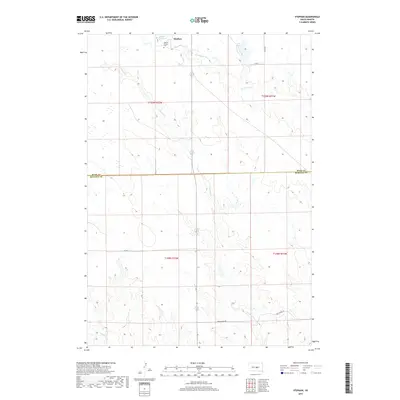
2017 Map of Stephan
USGS Topo · Published 2017About this map
Stephan sits at the heart of this prairie landscape, serving as a focal point in a region defined by its wide-open drainage basins and scattered water bodies. The settlement is home to the Stephan Mission, an important local landmark that, along with a nearby Cem, offers significant points of interest for genealogists and local historians. This 2017 survey details the boundary where Hyde and Buffalo Counties meet, illustrating how the modern road network, including Bad Nation Rd and Bia RD 7, navigates the rolling topography.
Find a feature on this map
17 named features on this map. Tap any name to fly to it.
Don’t see what you’re looking for? This feature index may not catch every label — zoom into the map to look around manually.
Map Details
Editions of this 2017 Stephan Map
This is the sole edition of this map. No revisions or reprints were ever made.
Other maps of this area

1953 · Huron
USGS Topo · 1:250,000

1954 · Huron
USGS Topo · 1:250,000

1966 · Big Bend Dam NE
USGS Topo · 1:24,000

1966 · Big Bend Dam SE
USGS Topo · 1:24,000

1966 · Stephan
USGS Topo · 1:24,000

1966 · Big Bend Dam
USGS Topo · 1:24,000

1966 · Lower Brule NE
USGS Topo · 1:24,000

1966 · Lower Brule
USGS Topo · 1:24,000

1973 · Chapelle Lake SE
USGS Topo · 1:24,000

1973 · Macs Corner SE
USGS Topo · 1:24,000
Featured Places
- Fort Thompson District, SD
- Grey Hill East Township, Fort Thompson District
- Grey Hill West Township, Fort Thompson District
- Stephan, Fort Thompson District
- Buffalo County, SD