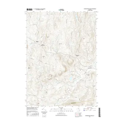
2016 Map of Stephentown Center
USGS Topo · Published 2016About this map
Stephentown Center and the surrounding hamlets of West Stephentown and Garfield define this rural landscape near the Rensselaer and Columbia county line. The terrain is characterized by a series of prominent peaks and ridges, including Johnson Hill, Buckwheat Hill, and Pomeroy Hill. These uplands are drained by a complex network of waterways such as Roaring Brook and Kinderhook Creek, with numerous smaller bodies of water like Stump Pond and Taplin Pond interspersed throughout the hills.
Find a feature on this map
97 named features on this map. Tap any name to fly to it.
Don’t see what you’re looking for? This feature index may not catch every label — zoom into the map to look around manually.
Map Details
Editions of this 2016 Stephentown Center Map
This is the sole edition of this map. No revisions or reprints were ever made.
Other maps of this area

1888 · Berlin
USGS Topo · 1:62,500

1888 · Pittsfield
USGS Topo · 1:62,500

1890 · Pittsfield
USGS Topo · 1:62,500

1890 · Berlin
USGS Topo · 1:62,500

1893 · Troy
USGS Topo · 1:62,500

1893 · Pittsfield
USGS Topo · 1:62,500

1894 · Berlin
USGS Topo · 1:62,500

1894 · Pittsfield
USGS Topo · 1:62,500

1895 · Troy
USGS Topo · 1:62,500

1897 · Pittsfield
USGS Topo · 1:62,500