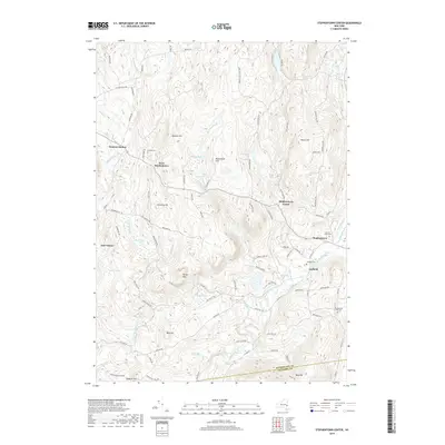
2019 Map of Stephentown Center
USGS Topo · Published 2019About this map
Stephentown Center and the surrounding villages of West Stephentown and Garfield occupy a landscape defined by the drainage of Kinderhook Creek and its many tributaries. This 2019 survey captures the modern rural character of eastern Rensselaer County, where the transition to Columbia County is marked at the southern edge of the sheet. The terrain is notably hilly, featuring prominent elevations like Johnson Hill and Pomeroy Hill that rise between the creek valleys.
Find a feature on this map
102 named features on this map. Tap any name to fly to it.
Don’t see what you’re looking for? This feature index may not catch every label — zoom into the map to look around manually.
Map Details
Editions of this 2019 Stephentown Center Map
This is the sole edition of this map. No revisions or reprints were ever made.
Other maps of this area

1888 · Berlin
USGS Topo · 1:62,500

1888 · Pittsfield
USGS Topo · 1:62,500

1890 · Pittsfield
USGS Topo · 1:62,500

1890 · Berlin
USGS Topo · 1:62,500

1893 · Troy
USGS Topo · 1:62,500

1893 · Pittsfield
USGS Topo · 1:62,500

1894 · Berlin
USGS Topo · 1:62,500

1894 · Pittsfield
USGS Topo · 1:62,500

1895 · Troy
USGS Topo · 1:62,500

1897 · Pittsfield
USGS Topo · 1:62,500