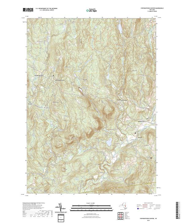
2023 Map of Stephentown Center
USGS Topo · Published 2023About this map
Stephentown Center and the surrounding highlands of eastern Rensselaer County are defined by a complex network of creeks and high ridges. The landscape is punctuated by numerous family and community landmarks, including Hillside Cem near West Stephentown and Presbyterian Hill Cem to the south. Waterways like Kinderhook Creek and Tackawasick Creek carve through the terrain, historically influencing the placement of settlements such as Dunham Hollow and Garfield.
Find a feature on this map
100 named features on this map. Tap any name to fly to it.
Don’t see what you’re looking for? This feature index may not catch every label — zoom into the map to look around manually.
Map Details
Editions of this 2023 Stephentown Center Map
This is the sole edition of this map. No revisions or reprints were ever made.
Other maps of this area

1888 · Berlin
USGS Topo · 1:62,500

1888 · Pittsfield
USGS Topo · 1:62,500

1890 · Pittsfield
USGS Topo · 1:62,500

1890 · Berlin
USGS Topo · 1:62,500

1893 · Troy
USGS Topo · 1:62,500

1893 · Pittsfield
USGS Topo · 1:62,500

1894 · Berlin
USGS Topo · 1:62,500

1894 · Pittsfield
USGS Topo · 1:62,500

1895 · Troy
USGS Topo · 1:62,500

1897 · Pittsfield
USGS Topo · 1:62,500