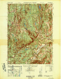
1948 Map of Stephentown Center
USGS Topo · Published 1948About this map
The hills and river valleys of Rensselaer County are captured here in a 1948 Army Map Service survey, centering on the rural community of Stephentown Center. The landscape is dominated by the Capital District State Forest Game Refuge, a sprawling wooded upland marked by the Seven Hill Firetower and the Airway Beacon on Buckpeat Hill. Settlement follows the watercourses and roads, with clusters at West Stephentown, Garfield, and Dunham Hollow.
Find a feature on this map
35 named features on this map. Tap any name to fly to it.
Don’t see what you’re looking for? This feature index may not catch every label — zoom into the map to look around manually.
Map Details
Editions of this 1948 Stephentown Center Map
This is the sole edition of this map. No revisions or reprints were ever made.
Other maps of this area

1888 · Berlin
USGS Topo · 1:62,500

1888 · Pittsfield
USGS Topo · 1:62,500

1890 · Pittsfield
USGS Topo · 1:62,500

1890 · Berlin
USGS Topo · 1:62,500

1893 · Troy
USGS Topo · 1:62,500

1893 · Pittsfield
USGS Topo · 1:62,500

1894 · Berlin
USGS Topo · 1:62,500

1894 · Pittsfield
USGS Topo · 1:62,500

1895 · Troy
USGS Topo · 1:62,500

1897 · Pittsfield
USGS Topo · 1:62,500