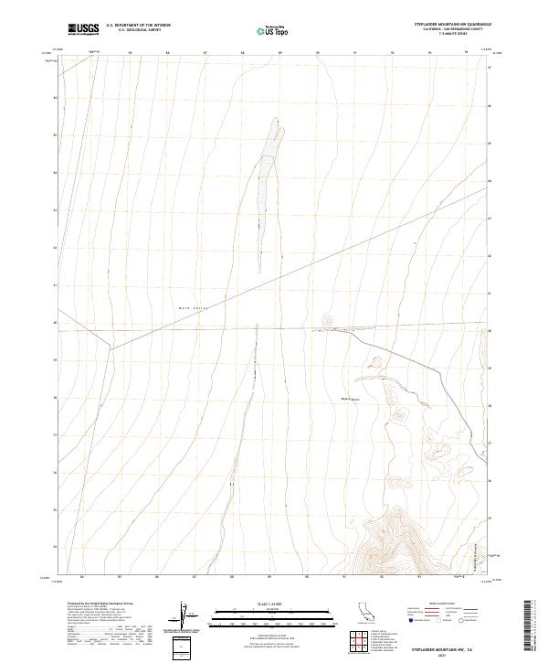
2021 Map of Stepladder Mountains NW
USGS Topo · Published 2021About this map
Ward Valley dominates the western portion of this landscape, characterized by the broad, low-relief basins typical of the Mojave Desert in eastern San Bernardino County. The topography is defined by the gradual descent from the surrounding uplands into the valley floor, where ephemeral drainage patterns are etched into the desert wash. In the southeastern corner of the quadrangle, the terrain rises sharply into the jagged foothills of the Stepladder Mountains, a stark contrast to the open alluvial flats to the west. This 2021 survey illustrates the remote character of this region, emphasizing the natural landforms and the Public Land Survey System grid that organizes this portion of the California desert.
Find a feature on this map
9 named features on this map. Tap any name to fly to it.
Don’t see what you’re looking for? This feature index may not catch every label — zoom into the map to look around manually.
Map Details
Editions of this 2021 Stepladder Mountains NW Map
This is the sole edition of this map. No revisions or reprints were ever made.
Other maps of this area

1942 · Amboy
USGS Topo · 1:250,000

1943 · Center Hills
USGS Topo · 1:62,500

1943 · Amboy
USGS Topo · 1:250,000

1943 · Essex
USGS Topo · 1:62,500

1943 · Fenner
USGS Topo · 1:62,500

1943 · Bannock
USGS Topo · 1:62,500

1954 · Needles
USGS Topo · 1:250,000

1956 · Needles
USGS Topo · 1:250,000

1956 · Fenner
USGS Topo · 1:62,500

1956 · Essex
USGS Topo · 1:62,500