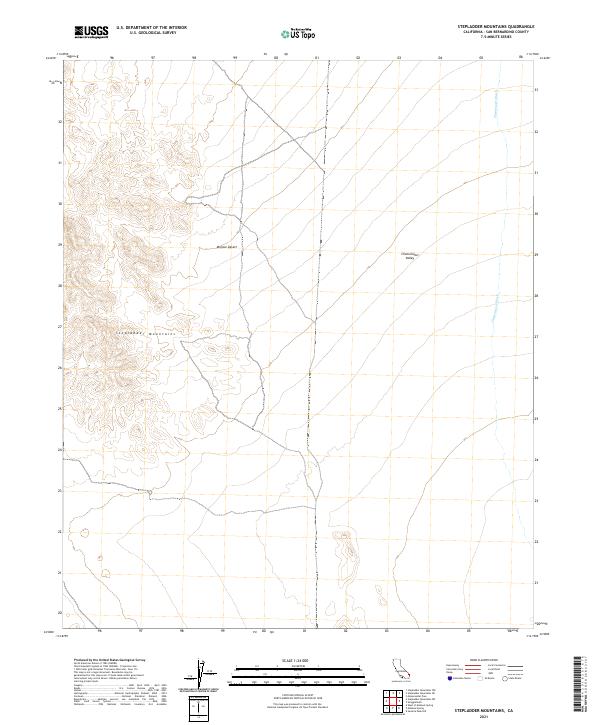
2021 Map of Stepladder Mountains
USGS Topo · Published 2021About this map
The Stepladder Mountains dominate the western portion of this San Bernardino County landscape, rising sharply above the arid floor of the Mojave Desert. This 2021 survey illustrates the stark topographical transition from the high relief of the mountains to the drainage systems of the Chemehuevi Valley in the east. The primary drainage feature, Chemehuevi Wash, meanders through the eastern section, tracing the natural path of seasonal runoff toward the valley floor. The map is defined by its traditional Public Land Survey System divisions, including sections within t6n r20e and t6n r21e, which provide a precise grid for modern land management in this uninhabited desert region.
Find a feature on this map
8 named features on this map. Tap any name to fly to it.
Don’t see what you’re looking for? This feature index may not catch every label — zoom into the map to look around manually.
Map Details
Editions of this 2021 Stepladder Mountains Map
This is the sole edition of this map. No revisions or reprints were ever made.
Other maps of this area

1903 · Needles
USGS Topo · 1:125,000

1904 · Needles Special
USGS Topo · 1:125,000

1943 · Center Hills
USGS Topo · 1:62,500

1943 · Turtle Mts.
USGS Topo · 1:62,500

1950 · Sawtooth Range
USGS Topo · 1:62,500

1950 · Savahia Peak
USGS Topo · 1:62,500

1951 · Savahia Peak
USGS Topo · 1:62,500

1951 · Sawtooth Range
USGS Topo · 1:62,500

1954 · Needles
USGS Topo · 1:250,000

1954 · Turtle Mountains
USGS Topo · 1:62,500