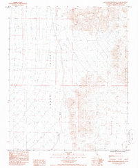
1985 Map of Stepladder Mountains SW
USGS Topo · Published 1985About this map
Stepladder Mountains dominate the eastern reaches of this 1985 survey, providing a sharp topographic contrast to the broad expanse of Ward Valley to the west. This arid landscape in San Bernardino County is defined by its drainage patterns, most notably the braided course of Homer Wash as it travels southward through the valley floor. The map records a sparsely developed desert environment where land management is delineated by the grid of Townships 5 and 6 North and Ranges 19 and 20 East. Apart from the natural terrain, the most distinct human or survey marker is the point labeled Avis in the southwestern quadrant, situated near the valley bottom. The lack of major infrastructure or settlements during this mid-1980s period highlights the preserve of wilderness and open range typical of the Mojave desert region.
Find a feature on this map
6 named features on this map. Tap any name to fly to it.
Don’t see what you’re looking for? This feature index may not catch every label — zoom into the map to look around manually.
Map Details
Editions of this 1985 Stepladder Mountains SW Map
This is the sole edition of this map. No revisions or reprints were ever made.
Other maps of this area

1942 · Amboy
USGS Topo · 1:250,000

1943 · Center Hills
USGS Topo · 1:62,500

1943 · Amboy
USGS Topo · 1:250,000

1943 · Essex
USGS Topo · 1:62,500

1943 · Turtle Mts.
USGS Topo · 1:62,500

1954 · Needles
USGS Topo · 1:250,000

1954 · Turtle Mountains
USGS Topo · 1:62,500

1956 · Needles
USGS Topo · 1:250,000

1956 · Milligan
USGS Topo · 1:62,500

1956 · Essex
USGS Topo · 1:62,500