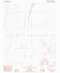
1985 Map of Stepladder Mts. NW
USGS Topo · Published 1985About this map
Ward Valley dominates this 1985 survey, showcasing a vast desert landscape shaped by arid drainage patterns and modern industrial infrastructure. The ephemeral flow of Homer Wash bisects the terrain, illustrating the natural hydrological corridors of the Mojave. This particular era of mapping captures the intersection of public land management and utility expansion, clearly marking an Underground Gas Pipeline and several Trans lines crossing the basin. The map detail reflects a period of meticulous aerial photogrammetry and field checking by the Geological Survey, recording the precise section lines and township boundaries that define land ownership in this portion of San Bernardino County. The prevalence of 4wd tracks indicates the limited but essential access routes used for utility maintenance and desert exploration during the mid-1980s.
Find a feature on this map
11 named features on this map. Tap any name to fly to it.
Don’t see what you’re looking for? This feature index may not catch every label — zoom into the map to look around manually.
Map Details
Editions of this 1985 Stepladder Mts. NW Map
This is the sole edition of this map. No revisions or reprints were ever made.
Other maps of this area

1942 · Amboy
USGS Topo · 1:250,000

1943 · Center Hills
USGS Topo · 1:62,500

1943 · Amboy
USGS Topo · 1:250,000

1943 · Essex
USGS Topo · 1:62,500

1943 · Fenner
USGS Topo · 1:62,500

1943 · Bannock
USGS Topo · 1:62,500

1954 · Needles
USGS Topo · 1:250,000

1956 · Needles
USGS Topo · 1:250,000

1956 · Fenner
USGS Topo · 1:62,500

1956 · Essex
USGS Topo · 1:62,500