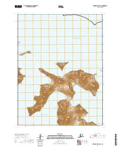
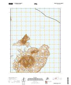
2020 Map of Stepovak Bay A-5 SE
USGS Topo · Published 2020About this map
Little Koniuji Island and the surrounding reaches of the Shumagin Islands define this maritime landscape where the Gulf of Alaska meets the Pacific Ocean. The topography is dominated by the complex, deeply indented coastline of the island, featuring protected anchorages like Northwest Harbor and Northeast Harbor. These natural harbors, along with Shoal Bay and Sandy Cove, suggest the critical role of seafaring and seasonal shelter in this part of the Aleutians East Borough. The waters are further complicated by hazards and navigational landmarks such as Murre Rocks, Hall Island, and the narrow Koniuji Strait. Small satellite landmasses like Atkins Island and Herendeen Island flank the main island, while Entrance Point marks a primary approach for vessels navigating the island's southeastern reaches.
Find a feature on this map
19 named features on this map. Tap any name to fly to it.
Don’t see what you’re looking for? This feature index may not catch every label — zoom into the map to look around manually.
Map Details
Editions of this 2020 Stepovak Bay A-5 SE Map
This is the sole edition of this map. No revisions or reprints were ever made.
Other maps of this area

1951 · Stepovak Bay
USGS Topo · 1:250,000
1963 · Simeonof Island D-2
USGS Topo · 1:63,360

1963 · Simeonof Island D-1
USGS Topo · 1:63,360
1963 · Stepovak Bay A-5
USGS Topo · 1:63,360

1963 · Simeonof Island
USGS Topo · 1:250,000

1963 · Stepovak Bay
USGS Topo · 1:250,000

1967 · Simeonof Island
USGS Topo · 1:250,000

1969 · Stepovak Bay
USGS Topo · 1:250,000
2020 · Simeonof Island D-2 NE
USGS Topo · 1:25,000
2020 · Simeonof Island D-1 NW
USGS Topo · 1:25,000