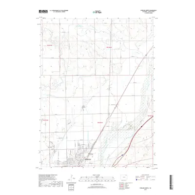
2019 Map of Sterling North
USGS Topo · Published 2019About this map
The Sterling city center and its northern agricultural outskirts are defined by an intricate network of irrigation infrastructure along the South Platte River. This landscape reveals a complex water-rights system essential to the region, featuring major arteries like the North Sterling Canal and the Lowline Ditch. In the northern sections, the terrain transitions into more arid rangeland dotted with reservoirs such as A Sherwin Reservoir Number 2, showing the distinct boundary between river-fed cultivation and high plains ranching. Within the city limits, the map identifies key community anchors including Northeastern Junior College and Sunset Memorial Gardens Cem. The grid of Sterling is bordered by industrial and agricultural transport routes like Riverside Dr and numerous numbered county roads that follow the township and range survey lines.
Find a feature on this map
70 named features on this map. Tap any name to fly to it.
Don’t see what you’re looking for? This feature index may not catch every label — zoom into the map to look around manually.
Map Details
Editions of this 2019 Sterling North Map
This is the sole edition of this map. No revisions or reprints were ever made.
Other maps of this area

1951 · Reiradon Hill
USGS Topo · 1:24,000

1951 · Sterling South
USGS Topo · 1:24,000

1951 · Sterling North
USGS Topo · 1:24,000

1951 · Galien
USGS Topo · 1:24,000

1951 · Atwood NE
USGS Topo · 1:24,000

1951 · Iliff
USGS Topo · 1:24,000

1951 · Atwood
USGS Topo · 1:24,000

1952 · Padroni
USGS Topo · 1:24,000

1954 · Sterling
USGS Topo · 1:250,000

1958 · Sterling
USGS Topo · 1:250,000