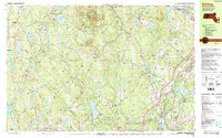
1988 Map of Sterling
USGS Topo · Published 1988About this map
Wachusett Mountain State Reservation dominates the northern landscape of this Worcester County region, where the heights of Wachusett Mountain and Little Wachusett Mtn overlook a complex network of reservoirs and basins. The late 20th-century water infrastructure is highly developed, featuring the massive Wachusett Reservoir and the Quabbin Aqueduct, which support the regional water supply. This era shows the established town centers of Sterling and Princeton alongside smaller historic clusters like Moores Corners and Quinapoxet.
Find a feature on this map
101 named features on this map. Tap any name to fly to it.
Don’t see what you’re looking for? This feature index may not catch every label — zoom into the map to look around manually.
Map Details
Editions of this 1988 Sterling Map
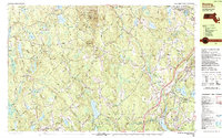
2 editions found
Other maps of this area

1885 · Worcester
USGS Topo · 1:62,500

1886 · Worcester
USGS Topo · 1:62,500

1887 · Winchendon
USGS Topo · 1:62,500

1887 · Marlboro
USGS Topo · 1:62,500

1887 · Barre
USGS Topo · 1:62,500

1887 · Fitchburg
USGS Topo · 1:62,500

1889 · Marlboro
USGS Topo · 1:62,500

1889 · Fitchburg
USGS Topo · 1:62,500

1889 · Barre
USGS Topo · 1:62,500

1890 · Winchendon
USGS Topo · 1:62,500