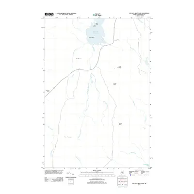
2011 Map of Stetson Mountain
USGS Topo · Published 2011About this map
Stetson Mountain and Owl Mountain dominate this corner of Washington County, defining a landscape of high ridges and significant glacial water bodies. The hydrology of the area is centered on Upper Hot Brook Lake, which is fed by Webster Brook and drains south via the winding West Branch Hot Brook. Landforms like Deadman Ridge and Bennett Ridge suggest a north-south geologic orientation that has dictated the path of local timber roads such as Schillinger Rd. In the northeast, the shoreline of Upper Hot Brook Lake is articulated by features like Kittery Island, Dark Point, and Shaw Point. This 2011 survey captures the area at a time when industrial logging roads and public land divisions, including Public Lot Ridge, shaped the human footprint on the Maine woods.
Find a feature on this map
27 named features on this map. Tap any name to fly to it.
Don’t see what you’re looking for? This feature index may not catch every label — zoom into the map to look around manually.
Map Details
Editions of this 2011 Stetson Mountain Map
This is the sole edition of this map. No revisions or reprints were ever made.
Other maps of this area

1931 · Springfield
USGS Topo · 1:48,000

1934 · Springfield
USGS Topo · 1:62,500

1940 · Danforth
USGS Topo · 1:62,500

1941 · Danforth
USGS Topo · 1:62,500

1941 · Scraggly Lake
USGS Topo · 1:62,500

1941 · Wytopitlock
USGS Topo · 1:62,500

1943 · Danforth
USGS Topo · 1:62,500

1943 · Wytopitlock
USGS Topo · 1:62,500

1944 · Scraggly Lake
USGS Topo · 1:62,500

1954 · Millinocket
USGS Topo · 1:250,000