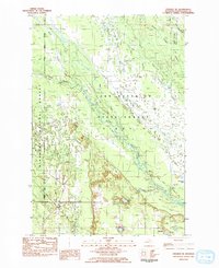
1983 Map of Steuben NE
USGS Topo · Published 1984About this map
Lake Superior State Forest and the Hiawatha National Forest converge in this Upper Peninsula landscape, where managed wilderness and historical transit routes define the terrain. The presence of the Haywire Grade across the northern section indicates the region's industrial past, likely representing a former logging rail line repurposed for modern access. Near the settlement of Ashford, local infrastructure is centered around Ashford Lake and the Townhall, while a Boat Ramp on Southside Lake points to the area's recreational use within the forest boundaries.
Find a feature on this map
60 named features on this map. Tap any name to fly to it.
Don’t see what you’re looking for? This feature index may not catch every label — zoom into the map to look around manually.
Map Details
Editions of this 1983 Steuben NE Map
This is the sole edition of this map. No revisions or reprints were ever made.
Other maps of this area

1931 · Steuben SE
USGS Topo · 1:31,680

1931 · Steuben SW
USGS Topo · 1:31,680

1931 · Steuben NE
USGS Topo · 1:31,680

1931 · Shingleton SW
USGS Topo · 1:31,680

1931 · Steuben NW
USGS Topo · 1:31,680

1931 · Manistique River NW
USGS Topo · 1:31,680

1931 · Shingleton SE
USGS Topo · 1:31,680

1931 · Manistique River SW
USGS Topo · 1:31,680

1931 · Driggs Lake SW
USGS Topo · 1:31,680

1958 · Shingleton
USGS Topo · 1:62,500