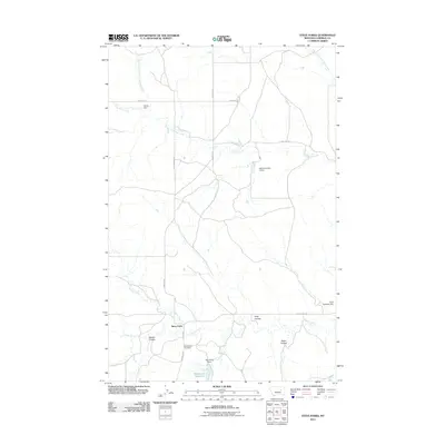
2011 Map of Steve Forks
USGS Topo · Published 2011About this map
Steve Forks sits at the convergence of rugged Montana coulees and essential water management features in Garfield County. The landscape is defined by its seasonal waterways, with Lone Tree Creek and its many forks carving through the terrain. Evidence of ranching and water conservation is found in the scattered infrastructure of the high plains, including the Waldo Number 2 Dam, Merlin Dam, and the Wheatcroft Reservoir. These small-scale water projects are vital in a region where Cherry Creek and Camp Creek flow intermittently toward larger basins.
Find a feature on this map
22 named features on this map. Tap any name to fly to it.
Don’t see what you’re looking for? This feature index may not catch every label — zoom into the map to look around manually.
Map Details
Editions of this 2011 Steve Forks Map
This is the sole edition of this map. No revisions or reprints were ever made.
Other maps of this area

1954 · Jordan
USGS Topo · 1:250,000

1956 · Jordan
USGS Topo · 1:250,000

1958 · Jordan
USGS Topo · 1:250,000

1964 · Jordan
USGS Topo · 1:250,000

1965 · Big Dry School
USGS Topo · 1:24,000

1965 · Edwards
USGS Topo · 1:24,000
1965 · Twin Buttes
USGS Topo · 1:24,000

1983 · Steve Forks
USGS Topo · 1:24,000
1983 · Blackfoot School
USGS Topo · 1:24,000
1983 · Brusett
USGS Topo · 1:24,000