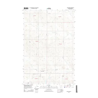
2014 Map of Steve Forks
USGS Topo · Published 2014About this map
Steve Forks and its surrounding drainage systems define this Garfield County landscape, where the high plains are carved by numerous intermittent waterways. The area is characterized by deep coulees, including Meckel Coulee in the southwest and Baker Coulee to the east, which drain into the branching networks of Steve Forks and Cherry Creek. This rural section of Montana reflects a pattern of isolated ranching infrastructure, where long-distance routes like Sand Springs Rd and Mail Rd connect the few named landmarks. The presence of the Steve Forks Cem serves as a significant genealogical marker for the families who settled this territory within the Township and Range system. Water remains the primary geographical driver, seen in the convergence of the E Fork Lone Tree Cr and N Fork Lone Tree Cr in the northern portion of the quadrangle.
Find a feature on this map
22 named features on this map. Tap any name to fly to it.
Don’t see what you’re looking for? This feature index may not catch every label — zoom into the map to look around manually.
Map Details
Editions of this 2014 Steve Forks Map
This is the sole edition of this map. No revisions or reprints were ever made.
Other maps of this area

1954 · Jordan
USGS Topo · 1:250,000

1956 · Jordan
USGS Topo · 1:250,000

1958 · Jordan
USGS Topo · 1:250,000

1964 · Jordan
USGS Topo · 1:250,000

1965 · Big Dry School
USGS Topo · 1:24,000

1965 · Edwards
USGS Topo · 1:24,000
1965 · Twin Buttes
USGS Topo · 1:24,000

1983 · Steve Forks
USGS Topo · 1:24,000
1983 · Blackfoot School
USGS Topo · 1:24,000
1983 · Brusett
USGS Topo · 1:24,000