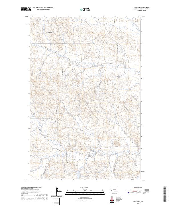
2024 Map of Steve Forks
USGS Topo · Published 2024About this map
Steve Forks is a quiet ranching outpost in Garfield County, defined by its drainage systems and the sparse infrastructure of the high plains. The landscape is carved by the Lone Tree Creek and its various tributaries, including the North Fork and East Fork, which wind through the northern sections of the township. Local history and family ties are anchored at the Steve Forks Cem, while the Wheatcroft Reservoir provides a critical point of water management in this arid environment. Roads like Edwards Rd and Steve's Fork Rd follow the natural contours of the coulees, illustrating a settlement pattern dictated by the terrain. The inclusion of Meckel Coulee and Baker Coulee highlights the complex topography that has shaped land use in this part of Montana for generations.
Find a feature on this map
25 named features on this map. Tap any name to fly to it.
Don’t see what you’re looking for? This feature index may not catch every label — zoom into the map to look around manually.
Map Details
Editions of this 2024 Steve Forks Map
This is the sole edition of this map. No revisions or reprints were ever made.
Other maps of this area

1954 · Jordan
USGS Topo · 1:250,000

1956 · Jordan
USGS Topo · 1:250,000

1958 · Jordan
USGS Topo · 1:250,000

1964 · Jordan
USGS Topo · 1:250,000

1965 · Big Dry School
USGS Topo · 1:24,000

1965 · Edwards
USGS Topo · 1:24,000
1965 · Twin Buttes
USGS Topo · 1:24,000

1983 · Steve Forks
USGS Topo · 1:24,000
1983 · Blackfoot School
USGS Topo · 1:24,000
1983 · Brusett
USGS Topo · 1:24,000