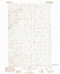
1983 Map of Steve Forks SW
USGS Topo · Published 1984About this map
Lone Tree Creek and Camp Creek carve through the arid drainage basins of central Montana in this early 1980s provisional study. The landscape is defined by the branching waterways of Steve Forks and the North Fork Lodgepole Creek in the south, while the northern terrain is crossed by the Dry Squaw Cr. A notable man-made feature of the era is the Wooden Pole Trans Line, which transects the high ground between the seasonal creek beds. This map reveals the intricate topographic detail of Garfield County just before the mid-1980s, illustrating how ranching-era infrastructure and utility corridors followed the natural contours of the breaks and coulees.
Find a feature on this map
6 named features on this map. Tap any name to fly to it.
Don’t see what you’re looking for? This feature index may not catch every label — zoom into the map to look around manually.
Map Details
Editions of this 1983 Steve Forks SW Map
This is the sole edition of this map. No revisions or reprints were ever made.
Other maps of this area

1954 · Jordan
USGS Topo · 1:250,000

1956 · Jordan
USGS Topo · 1:250,000

1958 · Jordan
USGS Topo · 1:250,000

1964 · Jordan
USGS Topo · 1:250,000

1965 · Edwards
USGS Topo · 1:24,000

1965 · Spring Creek School
USGS Topo · 1:24,000
1965 · Twin Buttes
USGS Topo · 1:24,000
1967 · Coffin Butte
USGS Topo · 1:24,000
1967 · Hay Coulee
USGS Topo · 1:24,000

1983 · Steve Forks
USGS Topo · 1:24,000