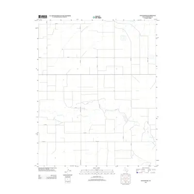
2012 Map of Stevens SW
USGS Topo · Published 2012About this map
Coldwater Creek and Frisco Creek carve intermittent drainage paths across this section of the northern Texas Panhandle, defining the subtle topography of Sherman County. The landscape is primarily organized by a rigid grid of county roads, reflecting the large-scale agricultural and ranching divisions characteristic of the region. Ranch Road 2232 serves as a primary north-south artery, connecting remote farmsteads and ranching operations. The network of local routes, including Co Road J and Co Road Q, reveals the systematic land partitioning used to manage this high plains environment. While largely devoid of dense population centers, the map captures the essential infrastructure of rural Texas life, from isolated structures to the critical watercourses that sustain the local livestock and farming economy in the early 21st century.
Find a feature on this map
14 named features on this map. Tap any name to fly to it.
Don’t see what you’re looking for? This feature index may not catch every label — zoom into the map to look around manually.
Map Details
Editions of this 2012 Stevens SW Map
This is the sole edition of this map. No revisions or reprints were ever made.
Other maps of this area

1954 · Perryton
USGS Topo · 1:250,000

1954 · Dalhart
USGS Topo · 1:250,000

1958 · Perryton
USGS Topo · 1:250,000

1958 · Dalhart
USGS Topo · 1:250,000

1962 · Dalhart
USGS Topo · 1:250,000

1964 · Stevens SW
USGS Topo · 1:24,000

1964 · Stratford
USGS Topo · 1:24,000

1964 · Stratford NE
USGS Topo · 1:24,000

1965 · Lautz
USGS Topo · 1:24,000

1965 · Spurlock Chapel
USGS Topo · 1:24,000