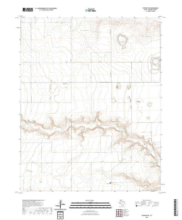
2022 Map of Stevens SW
USGS Topo · Published 2022About this map
Coldwater Cem stands as a quiet focal point in this portion of the Texas Panhandle, situated near the winding breaks of Coldwater Creek. The landscape is defined by the sharp contrast between the level upland plains and the deeply incised drainage systems that feed into Eriseo Creek to the north. These drainages create natural topographic relief in an otherwise strictly surveyed grid of county roads.
Find a feature on this map
16 named features on this map. Tap any name to fly to it.
Don’t see what you’re looking for? This feature index may not catch every label — zoom into the map to look around manually.
Map Details
Editions of this 2022 Stevens SW Map
This is the sole edition of this map. No revisions or reprints were ever made.
Other maps of this area

1954 · Perryton
USGS Topo · 1:250,000

1954 · Dalhart
USGS Topo · 1:250,000

1958 · Perryton
USGS Topo · 1:250,000

1958 · Dalhart
USGS Topo · 1:250,000

1962 · Dalhart
USGS Topo · 1:250,000

1964 · Stevens SW
USGS Topo · 1:24,000

1964 · Stratford
USGS Topo · 1:24,000

1964 · Stratford NE
USGS Topo · 1:24,000

1965 · Lautz
USGS Topo · 1:24,000

1965 · Spurlock Chapel
USGS Topo · 1:24,000