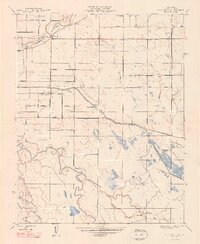
1948 Map of Stevinson
USGS Topo · Published 1948About this map
The confluence of the Merced River and San Joaquin River dominates this mid-century landscape of Merced County, where an intricate network of waterways supports a burgeoning agricultural economy. Large landholdings such as Gallo Ranch, Arakelian Ranch, and Howard Ranch define the territory, linked by a grid of rural routes including West Side Boulevard and Magnolia Avenue. The settlement of Stevinson serves as a central hub, situated near the engineering works of the East Side Canal and the Flume system that redirects water across the valley floor. Evidence of the region's hydraulic development is visible through features like Lake Honda and the various branches of Salt Slough and Deep Slough, while the Milliken Bridge provides a vital river crossing for the local transit of the late 1940s.
Find a feature on this map
26 named features on this map. Tap any name to fly to it.
Don’t see what you’re looking for? This feature index may not catch every label — zoom into the map to look around manually.
Map Details
Editions of this 1948 Stevinson Map
2 editions found
Other maps of this area

1916 · Mitchell School
USGS Topo · 1:31,680

1916 · Cressey
USGS Topo · 1:31,680

1917 · Turlock
USGS Topo · 1:31,680

1918 · Arena
USGS Topo · 1:31,680

1918 · Stevinson
USGS Topo · 1:31,680

1918 · Gustine
USGS Topo · 1:31,680

1918 · Turner Ranch
USGS Topo · 1:31,680

1919 · San Luis Ranch
USGS Topo · 1:31,680

1919 · Ingomar
USGS Topo · 1:31,680
1942 · Irwin
USGS Topo · 1:62,500