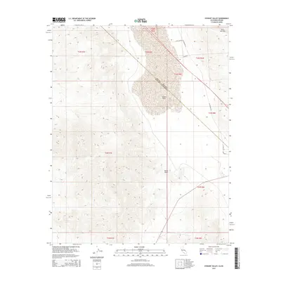
2015 Map of Stewart Valley
USGS Topo · Published 2015About this map
Stewart Valley sits at the intersection of the Nye County, Nevada, and Inyo County, California state line, where the high desert terrain transitions into the northern Mojave Desert. This 2015 U.S. Geological Survey representation documents the arid basin and the surrounding geological formations, including the Devils Hole Hills to the northeast. The map provides a detailed view of the remote road network that services this borderland region, such as White Hawk Rd, Ash Meadows Rd, and Baker Rd. These routes track the natural contours of the valley floor, illustrating the spatial relationship between the basin's sediment-heavy lowlands and the steep, rising ridges that define the landscape. Small local thoroughfares like Agate St and Condor Rd appear near the southern portion of the quadrangle, indicating pockets of development or access points within the desert expanse.
Find a feature on this map
9 named features on this map. Tap any name to fly to it.
Don’t see what you’re looking for? This feature index may not catch every label — zoom into the map to look around manually.
Map Details
Editions of this 2015 Stewart Valley Map
This is the sole edition of this map. No revisions or reprints were ever made.
Other maps of this area

1908 · Furnace Creek
USGS Topo · 1:250,000

1910 · Furnace Creek
USGS Topo · 1:250,000

1940 · Eagle Tank
USGS Topo · 1:62,500

1948 · Death Valley
USGS Topo · 1:250,000

1951 · Eagle Mtn
USGS Topo · 1:62,500

1952 · Ash Meadows
USGS Topo · 1:62,500

1954 · Death Valley
USGS Topo · 1:250,000

1956 · Death Valley
USGS Topo · 1:250,000

1957 · Death Valley
USGS Topo · 1:250,000

1958 · Death Valley
USGS Topo · 1:250,000