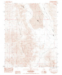
1984 Map of Stewart Valley
USGS Topo · Published 1984About this map
Stewart Valley is defined by a sparse desert landscape where state and county boundaries intersect the high desert of the California-Nevada border. The map illustrates the geographical transition between the Resting Spring Range and the Nopah Range, with a prominent Dry Lake serving as a central catchment. A significant historical marker, the Von Schmidt Line (1873), cuts diagonally across the terrain, representing an early and contested survey of the state boundary. Resource extraction is evident in the southern and eastern reaches, marked by the Shaw Mine and localized operations like a Gravel Pit and Prospect. Movement through this arid corridor relies on the Ash Meadows Road, which connects the rugged mountain slopes to the valley floor during the early 1980s.
Find a feature on this map
11 named features on this map. Tap any name to fly to it.
Don’t see what you’re looking for? This feature index may not catch every label — zoom into the map to look around manually.
Map Details
Editions of this 1984 Stewart Valley Map
This is the sole edition of this map. No revisions or reprints were ever made.
Other maps of this area

1908 · Furnace Creek
USGS Topo · 1:250,000

1910 · Furnace Creek
USGS Topo · 1:250,000

1940 · Eagle Tank
USGS Topo · 1:62,500

1948 · Death Valley
USGS Topo · 1:250,000

1951 · Eagle Mtn
USGS Topo · 1:62,500

1952 · Ash Meadows
USGS Topo · 1:62,500

1954 · Death Valley
USGS Topo · 1:250,000

1956 · Death Valley
USGS Topo · 1:250,000

1957 · Death Valley
USGS Topo · 1:250,000

1958 · Death Valley
USGS Topo · 1:250,000