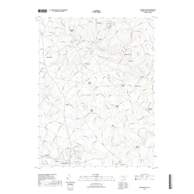
2019 Map of Stewartstown
USGS Topo · Published 2019About this map
York County's agricultural and milling heritage remains visible across this 2019 landscape, where numerous historic mill sites dot the winding waterways. Local industry once thrived at Sechrist Mill on the N Br Muddy Cr and farther south at Bacon Mill along Rambo Run. The settlement pattern in this area is characterized by small, dispersed villages like Brogueville, Felton, and Winterstown that grew around early crossroads and water power sites. Genealogists can locate several burial grounds including Old Roundhill Cem and Shaffer Cem, while the town of Stewartstown serves as a primary hub in the southwestern corner of the quadrangle. The terrain is defined by the drainage basins of Leibs Cr and Ebaughs Cr, illustrating the relationship between the rolling hills of southern Pennsylvania and the stream networks that shaped early commerce.
Find a feature on this map
184 named features on this map. Tap any name to fly to it.
Don’t see what you’re looking for? This feature index may not catch every label — zoom into the map to look around manually.
Map Details
Editions of this 2019 Stewartstown Map
This is the sole edition of this map. No revisions or reprints were ever made.
Other maps of this area

1900 · Parkton
USGS Topo · 1:62,500

1901 · Belair
USGS Topo · 1:62,500

1902 · Parkton
USGS Topo · 1:62,500

1908 · York
USGS Topo · 1:62,500

1910 · York
USGS Topo · 1:62,500

1912 · Mc Calls Ferry
USGS Topo · 1:62,500

1942 · Bel Air
USGS Topo · 1:62,500

1943 · Mc Calls Ferry
USGS Topo · 1:62,500

1944 · New Freedom
USGS Topo · 1:31,680

1944 · Norrisville
USGS Topo · 1:31,680