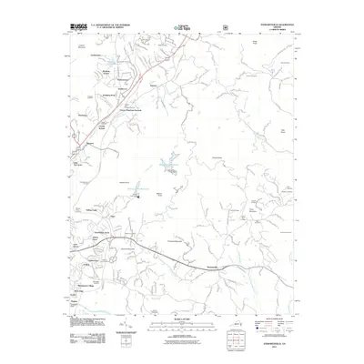
2011 Map of Stewartsville
USGS Topo · Published 2011About this map
Coyner Mountain and the Blue Ridge Parkway dominate the western terrain of this Virginia quadrangle, where modern suburban development meets the older rural bones of Roanoke and Bedford Counties. The landscape is dotted with small residential communities such as Laymantown, Rainbow Forest, and Bonsack, alongside industrial markers like the Norfolk and Western railway. Notable water management features include the Beaverdam Reservoir and Falling Creek Reservoir, which sit among the various knobs and mountains that define the local relief.
Find a feature on this map
69 named features on this map. Tap any name to fly to it.
Don’t see what you’re looking for? This feature index may not catch every label — zoom into the map to look around manually.
Map Details
Editions of this 2011 Stewartsville Map
This is the sole edition of this map. No revisions or reprints were ever made.
Other maps of this area

1890 · Roanoke
USGS Topo · 1:125,000

1891 · Roanoke
USGS Topo · 1:125,000

1929 · Roanoke
USGS Topo · 1:48,000

1933 · Roanoke
USGS Topo · 1:62,500

1947 · Roanoke
USGS Topo · 1:250,000

1950 · Peaks of Otter
USGS Topo · 1:62,500

1951 · Boones Mill
USGS Topo · 1:62,500

1951 · Moneta
USGS Topo · 1:62,500

1959 · Roanoke
USGS Topo · 1:250,000
1962 · Roanoke
USGS Topo · 1:24,000