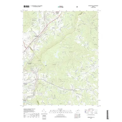
2019 Map of Stewartsville
USGS Topo · Published 2019About this map
Jefferson National Forest dominates the northern reaches of this landscape, where the Blue Ridge mountains rise sharply above the valley floor. This 2019 survey captures the rugged corridor of the Blue Ridge Pkwy, including the Coyner Mountain Overlook, as it winds through a terrain defined by prominent peaks like Stewart Knob and Chestnut Mtn. In the lowlands, the Roanoke River drainage shapes the settlement patterns, particularly near Vinton and the Niagara community.
Find a feature on this map
55 named features on this map. Tap any name to fly to it.
Don’t see what you’re looking for? This feature index may not catch every label — zoom into the map to look around manually.
Map Details
Editions of this 2019 Stewartsville Map
This is the sole edition of this map. No revisions or reprints were ever made.
Other maps of this area

1890 · Roanoke
USGS Topo · 1:125,000

1891 · Roanoke
USGS Topo · 1:125,000

1929 · Roanoke
USGS Topo · 1:48,000

1933 · Roanoke
USGS Topo · 1:62,500

1947 · Roanoke
USGS Topo · 1:250,000

1950 · Peaks of Otter
USGS Topo · 1:62,500

1951 · Boones Mill
USGS Topo · 1:62,500

1951 · Moneta
USGS Topo · 1:62,500

1959 · Roanoke
USGS Topo · 1:250,000
1962 · Roanoke
USGS Topo · 1:24,000