2022 Map of Stewartsville
USGS Topo · Published 2022About this map
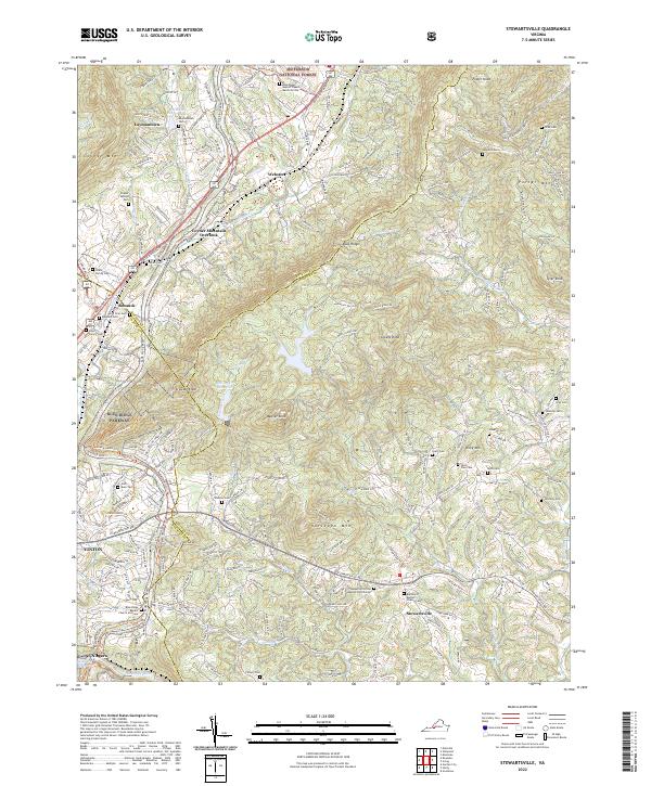
Stewartsville Rd serves as the central artery for this section of the Blue Ridge foothills, connecting the namesake community of Stewartsville to the surrounding rural landscape. The map reveals a high density of family and community burial grounds, such as Waldron Cem, Foutz Family Cem, and Lawhorn Cem, highlighting the deep genealogical roots of this area. The rugged topography is defined by prominent peaks like Greens Knob, Weaver Knob, and Coyner Mtn, which frame the valley floors and the waters of Falling Cr Reservoir. Along the western edge, the Blue Ridge Parkway traces the ridgeline, providing access to landmarks like the Coyner Mountain Overlook. Religious centers including the Basham Primitive Baptist Church Cem and the Blue-Ridge Baptist Church Memorial Site provide focal points for the scattered settlements of Webster and Laymantown.
Find a feature on this map
59 named features on this map. Tap any name to fly to it.
Don’t see what you’re looking for? This feature index may not catch every label — zoom into the map to look around manually.
Map Details
Editions of this 2022 Stewartsville Map
This is the sole edition of this map. No revisions or reprints were ever made.
Historical Maps of Rainbow Forest Through Time
3 maps found