
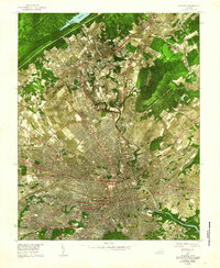
1977 Map of Stewartsville
USGS Topo · Published 1983About this map
Stewartsville anchors the southeastern portion of this landscape, situated near the foothills of Horsepen Mountain. This 1977 aerial orthophotograph, published by the U.S. Geological Survey in cooperation with the Soil Conservation Service, documents the transition between the valley floor and the rising slopes of the Blue Ridge. The terrain is deeply carved by a network of waterways, including Falling Creek and Glade Creek, which flow toward the southern boundary at the Roanoke River.
Find a feature on this map
12 named features on this map. Tap any name to fly to it.
Don’t see what you’re looking for? This feature index may not catch every label — zoom into the map to look around manually.
Map Details
Editions of this 1977 Stewartsville Map
This is the sole edition of this map. No revisions or reprints were ever made.
Other maps of this area

1890 · Roanoke
USGS Topo · 1:125,000

1891 · Roanoke
USGS Topo · 1:125,000

1929 · Roanoke
USGS Topo · 1:48,000

1933 · Roanoke
USGS Topo · 1:62,500

1947 · Roanoke
USGS Topo · 1:250,000

1950 · Peaks of Otter
USGS Topo · 1:62,500

1951 · Boones Mill
USGS Topo · 1:62,500

1951 · Moneta
USGS Topo · 1:62,500

1959 · Roanoke
USGS Topo · 1:250,000
1962 · Roanoke
USGS Topo · 1:24,000