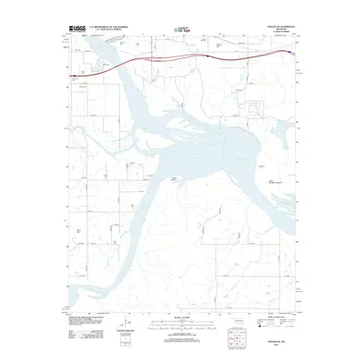
2012 Map of Stigler NE
USGS Topo · Published 2012About this map
The Arkansas River and the Canadian River converge in this riverine landscape, where the waters of the Robert S Kerr Reservoir dominate the central topography. This area is dense with family and community heritage, evidenced by more than a dozen documented burial grounds including Starr Cem, Foreman Cem, and Kyle Cem. The landscape transitions from the broad alluvial plains of Hisaw Bottom and Upper Sandtown Bottom to prominent elevations like Harris Mtn and Round Mtn. The map reveals a complex hydraulic network where the Illinois River, Negro Cr, and Brier Cr feed into the primary river systems. Historically significant routes, such as Old Hwy 64, traverse the northern sections, providing a record of the region's early transportation infrastructure alongside numerous rural county roads.
Find a feature on this map
42 named features on this map. Tap any name to fly to it.
Don’t see what you’re looking for? This feature index may not catch every label — zoom into the map to look around manually.
Map Details
Editions of this 2012 Stigler NE Map
This is the sole edition of this map. No revisions or reprints were ever made.
Other maps of this area

1898 · Tahlequah
USGS Topo · 1:125,000

1900 · Sansbois
USGS Topo · 1:125,000

1900 · Sallisaw
USGS Topo · 1:125,000

1901 · Muscogee
USGS Topo · 1:125,000

1901 · Tahlequah
USGS Topo · 1:125,000

1905 · Muscogee
USGS Topo · 1:125,000

1905 · Tahlequah
USGS Topo · 1:125,000

1909 · Sans Bois
USGS Topo · 1:125,000

1911 · Sallisaw
USGS Topo · 1:125,000

1911 · Sansbois
USGS Topo · 1:125,000