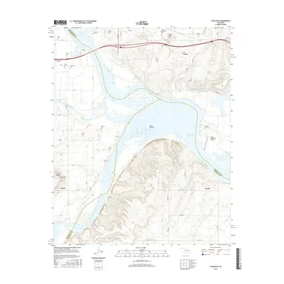
2016 Map of Stigler NE
USGS Topo · Published 2016About this map
The Canadian River and the Robert S Kerr Reservoir dominate this landscape at the intersection of Haskell, Muskogee, and Sequoyah Counties. The community of Tamaha sits near the riverbanks, where the terrain shifts from the low-lying Hisaw Bottom and Upper Sandtown Bottom to the rising elevations of Round Mtn and Harris Mtn. This area is characterized by a dense concentration of family and community burial grounds, including Foreman Cem, Vann Cem, and Starr Cem, which reflect the deep-rooted settlement patterns of the region. The map captures the interface between the river's floodplain and the surrounding uplands, with the Sandtown Woods Nature Trail winding through the bottomlands. To the north, the small settlements of Carlisle and Simms are connected by a network of rural routes like N State Hwy 10, illustrating the agricultural and river-based footprint of this Oklahoma territory.
Find a feature on this map
51 named features on this map. Tap any name to fly to it.
Don’t see what you’re looking for? This feature index may not catch every label — zoom into the map to look around manually.
Map Details
Editions of this 2016 Stigler NE Map
This is the sole edition of this map. No revisions or reprints were ever made.
Other maps of this area

1898 · Tahlequah
USGS Topo · 1:125,000

1900 · Sansbois
USGS Topo · 1:125,000

1900 · Sallisaw
USGS Topo · 1:125,000

1901 · Muscogee
USGS Topo · 1:125,000

1901 · Tahlequah
USGS Topo · 1:125,000

1905 · Muscogee
USGS Topo · 1:125,000

1905 · Tahlequah
USGS Topo · 1:125,000

1909 · Sans Bois
USGS Topo · 1:125,000

1911 · Sallisaw
USGS Topo · 1:125,000

1911 · Sansbois
USGS Topo · 1:125,000