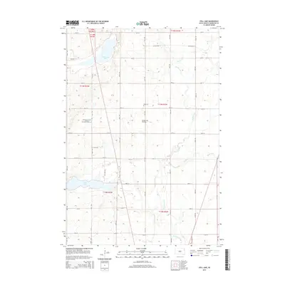
2015 Map of Still Lake
USGS Topo · Published 2015About this map
Coteau des Prairies defines the rolling topography of this Codington County landscape, where glacial features have created a network of prairie lakes and streams. The Big Sioux River meanders through the eastern sections, joined by tributaries like Soo Cr and Mahoney Cr. Settled areas are anchored by several historic burial grounds, including the Saint Maurice Esterly Blessed Sacrament Catholic Cem and Esterly Cem, marking the spiritual and communal centers for the local farming families. The land is organized by a strict grid of section roads, with Still Lake and Cottonwood Lake serving as prominent water bodies in an area largely dedicated to agriculture. This survey provides a clear view of the rural infrastructure, from county routes like CR-17 to the quiet placement of the Berger Cem amidst the fields.
Find a feature on this map
34 named features on this map. Tap any name to fly to it.
Don’t see what you’re looking for? This feature index may not catch every label — zoom into the map to look around manually.
Map Details
Editions of this 2015 Still Lake Map
This is the sole edition of this map. No revisions or reprints were ever made.
Other maps of this area

1953 · Milbank
USGS Topo · 1:250,000

1953 · Watertown
USGS Topo · 1:250,000

1958 · Milbank
USGS Topo · 1:250,000

1958 · Watertown
USGS Topo · 1:250,000

1969 · Watertown West
USGS Topo · 1:24,000

1969 · Watertown East
USGS Topo · 1:24,000

1970 · Lonesome Lake
USGS Topo · 1:24,000

1970 · Still Lake SE
USGS Topo · 1:24,000

1970 · Florence NE
USGS Topo · 1:24,000

1970 · Still Lake NE
USGS Topo · 1:24,000
Featured Places
- Germantown Township, SD
- Enemy Swim District, SD
- Fuller Township, SD
- Rauville Township, SD
- Dexter Township, SD