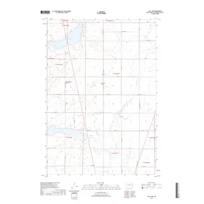
2017 Map of Still Lake
USGS Topo · Published 2017About this map
Coteau des Prairies, a vast plateau extending across the eastern Dakotas, defines the rolling topography of this Codington County landscape. The area is characterized by its glacial hydrology, featuring terminal moraine lakes like Cottonwood Lake and the smaller Still Lake to the south. These water bodies are connected to a drainage network that includes the Big Sioux River, Soo Cr, and Mahoney Cr, illustrating the complex prairie pothole region of the Upper Midwest.
Find a feature on this map
28 named features on this map. Tap any name to fly to it.
Don’t see what you’re looking for? This feature index may not catch every label — zoom into the map to look around manually.
Map Details
Editions of this 2017 Still Lake Map
This is the sole edition of this map. No revisions or reprints were ever made.
Other maps of this area

1953 · Milbank
USGS Topo · 1:250,000

1953 · Watertown
USGS Topo · 1:250,000

1958 · Milbank
USGS Topo · 1:250,000

1958 · Watertown
USGS Topo · 1:250,000

1969 · Watertown West
USGS Topo · 1:24,000

1969 · Watertown East
USGS Topo · 1:24,000

1970 · Lonesome Lake
USGS Topo · 1:24,000

1970 · Still Lake SE
USGS Topo · 1:24,000

1970 · Florence NE
USGS Topo · 1:24,000

1970 · Still Lake NE
USGS Topo · 1:24,000
Featured Places
- Germantown Township, SD
- Enemy Swim District, SD
- Fuller Township, SD
- Rauville Township, SD
- Dexter Township, SD