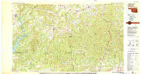
1978 Map of Stilwell
USGS Topo · Published 1979About this map
Stilwell and the surrounding Ozark plateau define this 1970s landscape, where the border between Oklahoma and Arkansas is marked by a complex network of ridges and river valleys. The town of Tahlequah serves as a western anchor, home to Northeastern State College, while to the east, the Arkansas side features established settlements like Prairie Grove and Lincoln. This era shows a region balanced between small-town commerce and the growing recreational draw of Tenkiller Ferry Lake and Devils Den State Park.
Find a feature on this map
141 named features on this map. Tap any name to fly to it.
Don’t see what you’re looking for? This feature index may not catch every label — zoom into the map to look around manually.
Map Details
Editions of this 1978 Stilwell Map
This is the sole edition of this map. No revisions or reprints were ever made.
Other maps of this area

1879 · Cravens
USGS Topo · 1:62,500

1879 · Fort Smith
USGS Topo · 1:62,500

1887 · Van Buren
USGS Topo · 1:62,500

1887 · Magazine Mountain #2
USGS Topo · 1:62,500

1887 · Watalula
USGS Topo · 1:62,500

1887 · Magazine Mountain
USGS Topo · 1:62,500

1890 · Magazine Mountain
USGS Topo · 1:125,000

1890 · Fort Smith
USGS Topo · 1:125,000

1896 · Pryor
USGS Topo · 1:125,000

1898 · Winslow #4
USGS Topo · 1:62,500