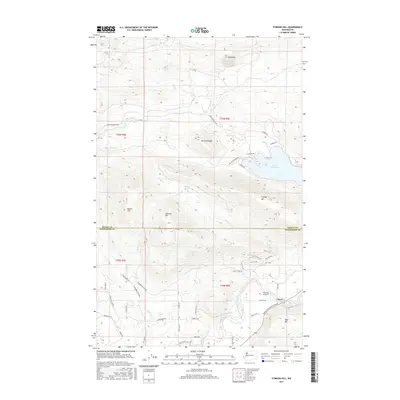
2017 Map of Stimson Hill
USGS Topo · Published 2017About this map
Lake Cavanaugh and its surrounding peaks dominate this 2017 survey of the borderlands between Skagit and Snohomish counties. The landscape is defined by significant elevations including Mt Cavanaugh, Frailey Mtn, and Stimson Hill, which overlook a complex drainage system fed by Pilchuck Cr, Grant Cr, and Crane Cr. In the southern portion of the quadrangle, the terrain descends toward the North Fork Stillaguamish River valley, where the small settlement of Cicero is situated.
Find a feature on this map
57 named features on this map. Tap any name to fly to it.
Don’t see what you’re looking for? This feature index may not catch every label — zoom into the map to look around manually.
Map Details
Editions of this 2017 Stimson Hill Map
This is the sole edition of this map. No revisions or reprints were ever made.
Other maps of this area

1899 · Stillaguamish
USGS Topo · 1:125,000

1901 · Stilaguamish
USGS Topo · 1:125,000

1911 · Mount Vernon
USGS Topo · 1:125,000

1941 · Marysville
USGS Topo · 1:62,500

1943 · Marysville
USGS Topo · 1:62,500

1944 · Clear Lake
USGS Topo · 1:62,500

1955 · Concrete
USGS Topo · 1:250,000

1956 · Arlington West
USGS Topo · 1:24,000

1956 · Arlington East
USGS Topo · 1:24,000
1956 · Clear Lake
USGS Topo · 1:62,500