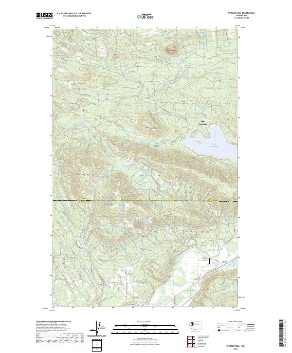
2023 Map of Stimson Hill
USGS Topo · Published 2023About this map
Lake Cavanaugh serves as the focal point of this highland region, surrounded by a network of seasonal residences and lakefront access roads like N Shore Dr and S Shore Dr. The landscape is defined by significant topographic rises including Mt Cavanaugh and Frailey Mtn, which separate the lake basin from the lower elevations near the settlement of Cicero to the southeast. Historically, this area spans the border of Skagit Co and Snohomish Co, reflecting a transition from the mountainous timberlands of the Cascades foothills to the river valley flats. Local aviation and recreation are marked by features such as the Williams Airpatch and the Grandview Trl, while the drainage of Pilchuck Creek and Grant Creek illustrates the complex hydrology of the watershed before it reaches the Stillaguamish River system.
Find a feature on this map
53 named features on this map. Tap any name to fly to it.
Don’t see what you’re looking for? This feature index may not catch every label — zoom into the map to look around manually.
Map Details
Editions of this 2023 Stimson Hill Map
This is the sole edition of this map. No revisions or reprints were ever made.
Other maps of this area

1899 · Stillaguamish
USGS Topo · 1:125,000

1901 · Stilaguamish
USGS Topo · 1:125,000

1911 · Mount Vernon
USGS Topo · 1:125,000

1941 · Marysville
USGS Topo · 1:62,500

1943 · Marysville
USGS Topo · 1:62,500

1944 · Clear Lake
USGS Topo · 1:62,500

1955 · Concrete
USGS Topo · 1:250,000

1956 · Arlington West
USGS Topo · 1:24,000

1956 · Arlington East
USGS Topo · 1:24,000
1956 · Clear Lake
USGS Topo · 1:62,500