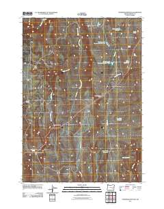
2011 Map of Stinkingwater Pass
USGS Topo · Published 2011About this map
Stinkingwater Pass serves as a critical point of passage through the arid landscape of eastern Oregon, where water sources dictated the patterns of human movement. This 2011 survey documents a network of named springs and small reservoirs that supported ranching and travel, including Buchanan Springs, Indian Grade Spring, and Big Pipe Spring. Evidence of high-desert habitation and infrastructure is visible at the Percy West Cabin and the Buchanan Springs Safety Rest Area, marking where local travelers found refuge. The terrain is characterized by broad flats like Negro Flat and Sagebrush Flat, which are drained by seasonal waterways such as Little Pine Creek and Clear Creek. These features illustrate the precarious balance of life in Harney County, where every named water source like Lazy Man Reservoir or Jims Reservoir represents a managed attempt to harness the environment.
Find a feature on this map
29 named features on this map. Tap any name to fly to it.
Don’t see what you’re looking for? This feature index may not catch every label — zoom into the map to look around manually.
Map Details
Editions of this 2011 Stinkingwater Pass Map
This is the sole edition of this map. No revisions or reprints were ever made.
Other maps of this area

1955 · Burns
USGS Topo · 1:250,000

1958 · Burns
USGS Topo · 1:250,000

1959 · Burns
USGS Topo · 1:250,000

1968 · Drewsey
USGS Topo · 1:62,500

1968 · Van
USGS Topo · 1:62,500

1973 · Buchanan
USGS Topo · 1:24,000

1973 · Mahon Creek
USGS Topo · 1:24,000

1973 · Carson Point
USGS Topo · 1:24,000
1977 · Bartlett Mtn
USGS Topo · 1:24,000
1978 · Stinkingwater Pass
USGS Topo · 1:24,000