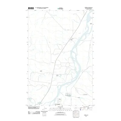
2011 Map of Stipek
USGS Topo · Published 2011About this map
The Yellowstone River anchors this 2011 topographic study of the Montana plains, winding past the small settlement of Stipek and the northern outskirts of Glendive. The landscape is defined by its water management and agricultural infrastructure, evidenced by features such as the Pettersen Number 1 Dam and Guelff Dam. High points like Custers Lookout and Bryants Buttes offer topographical contrast to the river bottomlands, while Schaffer Island sits within the shifting channels of the river. To the south, the presence of the Dawson County Fairgrounds and Glendive Campground suggests the transition from rural prairie to suburban development. Local water sources including Crisafulli Lake and Holecker Reservoir highlight the importance of irrigation and water storage in this semi-arid region of Dawson County.
Find a feature on this map
25 named features on this map. Tap any name to fly to it.
Don’t see what you’re looking for? This feature index may not catch every label — zoom into the map to look around manually.
Map Details
Editions of this 2011 Stipek Map
This is the sole edition of this map. No revisions or reprints were ever made.
Other maps of this area

1909 · Glendive
USGS Topo · 1:250,000

1954 · Glendive
USGS Topo · 1:250,000

1957 · Glendive
USGS Topo · 1:250,000

1958 · Glendive
USGS Topo · 1:250,000

1966 · Kolberg Ranch
USGS Topo · 1:24,000

1966 · Intake
USGS Topo · 1:24,000

1967 · Stipek
USGS Topo · 1:24,000

1967 · Allard
USGS Topo · 1:24,000

1967 · Belle Prairie
USGS Topo · 1:24,000
1967 · Glendive
USGS Topo · 1:24,000