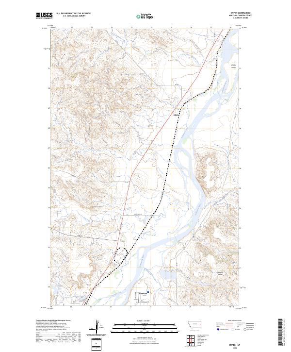
2024 Map of Stipek
USGS Topo · Published 2024About this map
The Yellowstone River serves as the central artery of this eastern Montana landscape, winding past the northern edge of Glendive and through a series of braided channels and landforms like Schaffer Island. The terrain is defined by dramatic elevation changes, notably at Custers Lookout and the Bryants Buttes, which overlook the surrounding drainages of Lower Sevenmile Creek and Deer Creek. The small settlement of Stipek sits along a junction of rural roads, representing the sparse residential character of the area north of the county seat.
Find a feature on this map
29 named features on this map. Tap any name to fly to it.
Don’t see what you’re looking for? This feature index may not catch every label — zoom into the map to look around manually.
Map Details
Editions of this 2024 Stipek Map
This is the sole edition of this map. No revisions or reprints were ever made.
Other maps of this area

1909 · Glendive
USGS Topo · 1:250,000

1954 · Glendive
USGS Topo · 1:250,000

1957 · Glendive
USGS Topo · 1:250,000

1958 · Glendive
USGS Topo · 1:250,000

1966 · Kolberg Ranch
USGS Topo · 1:24,000

1966 · Intake
USGS Topo · 1:24,000

1967 · Stipek
USGS Topo · 1:24,000

1967 · Allard
USGS Topo · 1:24,000

1967 · Belle Prairie
USGS Topo · 1:24,000
1967 · Glendive
USGS Topo · 1:24,000