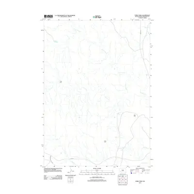
2012 Map of Stirk Table
USGS Topo · Published 2012About this map
Stirk Table and the high plateaus of Oglala Lakota County define this landscape, where the northern edge of Badlands National Park meets a network of intermittent drainages. The White River winds across the southern reaches of the quadrangle, serving as a primary hydrological feature in an area marked by erosional landmarks like Cedar Butte and V-Tail Draw. Transport through this terrain is represented by BIA Road 2 and the Big Foot Trl, the latter following the higher ground of the eastern ridges. The drainage patterns of Fog Cr, N Cottonwood Cr, and Cottonwood Cr illustrate the complex topography characteristic of the region's semi-arid environment, showing how water has carved the tablelands over time.
Find a feature on this map
11 named features on this map. Tap any name to fly to it.
Don’t see what you’re looking for? This feature index may not catch every label — zoom into the map to look around manually.
Map Details
Editions of this 2012 Stirk Table Map
This is the sole edition of this map. No revisions or reprints were ever made.
Other maps of this area

1950 · Sheep Mountain Table
USGS Topo · 1:24,000

1950 · Stirk Table
USGS Topo · 1:24,000

1950 · Cuny Table East
USGS Topo · 1:24,000

1950 · Imlay SW
USGS Topo · 1:24,000

1950 · Imlay
USGS Topo · 1:24,000

1951 · Sharps Corner
USGS Topo · 1:24,000

1951 · Heutmacher Table
USGS Topo · 1:24,000

1951 · Rockyford NW
USGS Topo · 1:24,000

1951 · Rockyford
USGS Topo · 1:24,000

1955 · Hot Springs
USGS Topo · 1:250,000