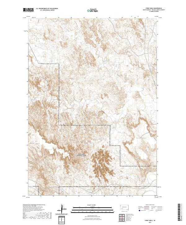
2021 Map of Stirk Table
USGS Topo · Published 2021About this map
Badlands National Park anchors this portion of the Oglala Lakota landscape, where the plateau surfaces of Stirk Table and Cuny Table stand above a complex drainage system. These high tables are bisected by erosional features like V-Tail Draw and are surrounded by a network of seasonal watercourses including Cottonwood Cr, N Cottonwood Cr, and Fog Cr. In the southern portion of the map, the terrain drops significantly toward the White River valley, a primary geographical landmark for the region. The map captures the specialized transportation network of the reservation, notably the Big Foot Trl Bia Hwy 27 and BIA Hwy 2. Significant topographical elevations are marked by Cedar Butte, providing a detailed look at the transition from the high prairie tables to the broken badlands and river bottoms.
Find a feature on this map
19 named features on this map. Tap any name to fly to it.
Don’t see what you’re looking for? This feature index may not catch every label — zoom into the map to look around manually.
Map Details
Editions of this 2021 Stirk Table Map
This is the sole edition of this map. No revisions or reprints were ever made.
Other maps of this area

1950 · Sheep Mountain Table
USGS Topo · 1:24,000

1950 · Stirk Table
USGS Topo · 1:24,000

1950 · Cuny Table East
USGS Topo · 1:24,000

1950 · Imlay SW
USGS Topo · 1:24,000

1950 · Imlay
USGS Topo · 1:24,000

1951 · Sharps Corner
USGS Topo · 1:24,000

1951 · Heutmacher Table
USGS Topo · 1:24,000

1951 · Rockyford NW
USGS Topo · 1:24,000

1951 · Rockyford
USGS Topo · 1:24,000

1955 · Hot Springs
USGS Topo · 1:250,000