
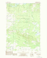
1983 Map of Stittsville
USGS Topo · Published 1984About this map
Pere Marquette State Forest dominates this section of Missaukee County, where the dense woodland is punctuated by high points like Allen Hill and extensive wetland systems. Small crossroads settlements like Moorestown, Stittsville, and Cutcheon define the human footprint, connected by a network of named logging and section roads including Sevenmile Road and Coombs Road. The landscape is defined by its transition between upland forest and low-lying marshes such as Thornton Swamp, Excelsior Swamp, and Remington Swamp.
Find a feature on this map
38 named features on this map. Tap any name to fly to it.
Don’t see what you’re looking for? This feature index may not catch every label — zoom into the map to look around manually.
Map Details
Editions of this 1983 Stittsville Map
This is the sole edition of this map. No revisions or reprints were ever made.
Other maps of this area

1949 · Fletcher
USGS Topo · 1:62,500

1950 · Fletcher
USGS Topo · 1:24,000

1954 · Traverse City
USGS Topo · 1:250,000

1956 · Kalkaska
USGS Topo · 1:62,500

1956 · Houghton Lake
USGS Topo · 1:62,500

1956 · Lake City
USGS Topo · 1:62,500

1958 · Traverse City
USGS Topo · 1:250,000

1983 · Cadillac
USGS Topo · 1:100,000

1983 · Lake City
USGS Topo · 1:25,000
1983 · Addis Creek
USGS Topo · 1:24,000