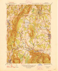
1948 Map of Stockbridge
USGS Topo · Published 1948About this map
The Housatonic River winds through the Berkshire landscape, anchoring a series of industrial and cultural settlements in the years following World War II. The map highlights the cultural importance of Tanglewood situated above the expansive Stockbridge Bowl, also known as Lake Mahkeenac. The river's path is shadowed by two major rail lines, the Boston & Albany RR and the New York New Haven & Hartford RR, which served the valley's mill towns and manufacturing centers. From the northern edge at Lenox to the industrial activity in Housatonic and South Lee, the map reveals a sophisticated network of local roads like Mohawk Lake Road and Glendale Road. Local history and geography intersect at prominent landmarks such as Rattlesnake Hill, Ice Glen, and Laura Tower, providing a clear look at the region's transition from a rail-dependent industrial valley to a summer cultural destination.
Find a feature on this map
71 named features on this map. Tap any name to fly to it.
Don’t see what you’re looking for? This feature index may not catch every label — zoom into the map to look around manually.
Map Details
Editions of this 1948 Stockbridge Map
3 editions found
Other maps of this area

1885 · Sheffield
USGS Topo · 1:62,500

1886 · Becket
USGS Topo · 1:62,500

1888 · Sheffield
USGS Topo · 1:62,500

1888 · Becket
USGS Topo · 1:62,500

1888 · Sandisfield
USGS Topo · 1:62,500

1888 · Pittsfield
USGS Topo · 1:62,500

1890 · Pittsfield
USGS Topo · 1:62,500

1891 · Sheffield
USGS Topo · 1:62,500

1893 · Becket
USGS Topo · 1:62,500

1893 · Sheffield
USGS Topo · 1:62,500