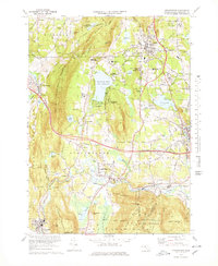
1973 Map of Stockbridge
USGS Topo · Published 1978About this map
The Housatonic River winds through the heart of the Berkshires in this early 1970s survey, illustrating a landscape defined by cultural institutions and protected forests. The prestigious cultural profile of the region is evident through Tanglewood Auditorium and the Chesterwood Museum, while the Stockbridge Bowl (Lake Mahkeenac) serves as a central geographic anchor for settlements like Interlaken and Beachwood. Mapping reveals a dense network of religious and educational sites, including the Immaculate Heart Seminary and The Marian Fathers Monastery, alongside local landmarks like the Laura Lookout Tower on Evergreen Hill. The Penn Central rail line follows the river valley, connecting the industrial and residential pockets of Housatonic, Glendale, and South Lee against the wooded backdrop of the Beartown State Forest.
Find a feature on this map
84 named features on this map. Tap any name to fly to it.
Don’t see what you’re looking for? This feature index may not catch every label — zoom into the map to look around manually.
Map Details
Editions of this 1973 Stockbridge Map
3 editions found
Other maps of this area

1885 · Sheffield
USGS Topo · 1:62,500

1886 · Becket
USGS Topo · 1:62,500

1888 · Sheffield
USGS Topo · 1:62,500

1888 · Becket
USGS Topo · 1:62,500

1888 · Sandisfield
USGS Topo · 1:62,500

1888 · Pittsfield
USGS Topo · 1:62,500

1890 · Pittsfield
USGS Topo · 1:62,500

1891 · Sheffield
USGS Topo · 1:62,500

1893 · Becket
USGS Topo · 1:62,500

1893 · Sheffield
USGS Topo · 1:62,500