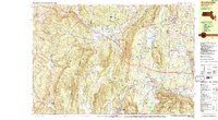
1987 Map of Stockbridge
USGS Topo · Published 1987About this map
Tanglewood Auditorium anchors the cultural landscape of the Berkshire Hills on this 1987 survey, situated between the waters of Stockbridge Bowl and the town center of Stockbridge. The map reveals a dense network of religious and educational institutions, including The Marian Helpers Monastery, Immaculate Heart Seminary, and Berkshire Christian College. This concentration reflects the region's long-standing tradition as a center for retreat and higher learning.
Find a feature on this map
101 named features on this map. Tap any name to fly to it.
Don’t see what you’re looking for? This feature index may not catch every label — zoom into the map to look around manually.
Map Details
Editions of this 1987 Stockbridge Map
2 editions found
Other maps of this area

1885 · Sheffield
USGS Topo · 1:62,500

1886 · Becket
USGS Topo · 1:62,500

1888 · Sheffield
USGS Topo · 1:62,500

1888 · Becket
USGS Topo · 1:62,500

1888 · Sandisfield
USGS Topo · 1:62,500

1888 · Pittsfield
USGS Topo · 1:62,500

1890 · Pittsfield
USGS Topo · 1:62,500

1891 · Sheffield
USGS Topo · 1:62,500

1893 · Becket
USGS Topo · 1:62,500

1893 · Sheffield
USGS Topo · 1:62,500