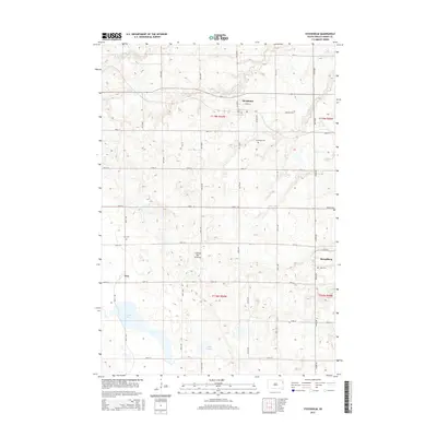
2015 Map of Stockholm
USGS Topo · Published 2015About this map
The Coteau des Prairies plateau defines the landscape of this Grant County region, where the high prairie is dotted with glacial wetlands and small rural settlements. This 2015 survey shows the town of Stockholm situated along the northern section, while Strandburg and the locality of Troy anchor the southern half of the map. The drainage patterns of the N Fork Yellow Bank River and the presence of Crooked Lake and Punyor Slough illustrate the unique hydrology of this terminal moraine environment.
Find a feature on this map
33 named features on this map. Tap any name to fly to it.
Don’t see what you’re looking for? This feature index may not catch every label — zoom into the map to look around manually.
Map Details
Editions of this 2015 Stockholm Map
This is the sole edition of this map. No revisions or reprints were ever made.
Other maps of this area

1953 · Milbank
USGS Topo · 1:250,000

1953 · Watertown
USGS Topo · 1:250,000

1958 · Milbank
USGS Topo · 1:250,000

1958 · Watertown
USGS Topo · 1:250,000

1970 · Kranzburg
USGS Topo · 1:24,000

1970 · Goodwin
USGS Topo · 1:24,000

1973 · Twin Brooks
USGS Topo · 1:24,000

1973 · LaBolt
USGS Topo · 1:24,000

1973 · Tunerville
USGS Topo · 1:24,000
1973 · Milbank West
USGS Topo · 1:24,000