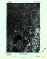
1975 Map of Stockholm SW
USGS Topo · Published 1981About this map
The timberlands and settled clearings of northern Aroostook County are documented in this orthophotoquad, which captures the landscape as it appeared in the mid-1970s. The village of Stockholm sits at the eastern edge of the sheet, while the smaller settlement of Jemtland marks the southern rural reaches. This imagery provides a rare overhead perspective on the region's land use, showing the distinct boundary between the dense forest cover and the agricultural plots around the settlements. The hydrology of the area is dominated by the sprawling Madawaska Lake, which feeds into the Madawaska River. Further north, the drainage is defined by Armstrong Brook, cutting through the heavy timber that characterizes much of the quadrangle. For those studying the evolution of Northern Maine, this document records the extent of development and the reach of local logging roads during this era.
Find a feature on this map
5 named features on this map. Tap any name to fly to it.
Don’t see what you’re looking for? This feature index may not catch every label — zoom into the map to look around manually.
Map Details
Editions of this 1975 Stockholm SW Map
This is the sole edition of this map. No revisions or reprints were ever made.
Other maps of this area

1927 · Stockholm
USGS Topo · 1:48,000

1927 · Square Lake
USGS Topo · 1:48,000

1929 · Portage
USGS Topo · 1:62,500

1929 · Caribou
USGS Topo · 1:48,000

1931 · Square Lake
USGS Topo · 1:62,500

1931 · Portage
USGS Topo · 1:62,500

1931 · Stockholm
USGS Topo · 1:62,500

1932 · Caribou
USGS Topo · 1:62,500

1953 · Stockholm
USGS Topo · 1:62,500

1953 · Square Lake
USGS Topo · 1:62,500