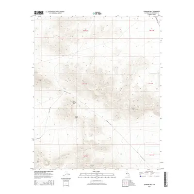
2015 Map of Stoddard Well
USGS Topo · Published 2015About this map
Stoddard Well and the surrounding high desert terrain dominate this 2015 survey of the Mojave Desert in San Bernardino County. The landscape is defined by the prominent Stoddard Ridge and the distinct peaks of Stoddard Mtn, Sidewinder Mtn, and Black Mtn. This area serves as a critical junction for desert travel, where the Lucerne Valley Cutoff and Stoddard Wells Rd intersect. The map illustrates the geographical transition between Stoddard Valley and North Lucerne Valley, providing an essential view of the traditional routes and watering points that have supported transit through this arid region for generations.
Find a feature on this map
17 named features on this map. Tap any name to fly to it.
Don’t see what you’re looking for? This feature index may not catch every label — zoom into the map to look around manually.
Map Details
Editions of this 2015 Stoddard Well Map
This is the sole edition of this map. No revisions or reprints were ever made.
Other maps of this area

1932 · Barstow
USGS Topo · 1:125,000

1934 · Barstow
USGS Topo · 1:125,000

1953 · San Bernardino
USGS Topo · 1:250,000

1955 · Ord Mountains
USGS Topo · 1:62,500

1956 · San Bernardino
USGS Topo · 1:250,000

1956 · Daggett
USGS Topo · 1:62,500

1956 · Barstow
USGS Topo · 1:62,500

1957 · Apple Valley
USGS Topo · 1:62,500

1957 · San Bernardino
USGS Topo · 1:250,000

1958 · San Bernardino
USGS Topo · 1:250,000